Mapping vegetation dynamics in Greater Mara
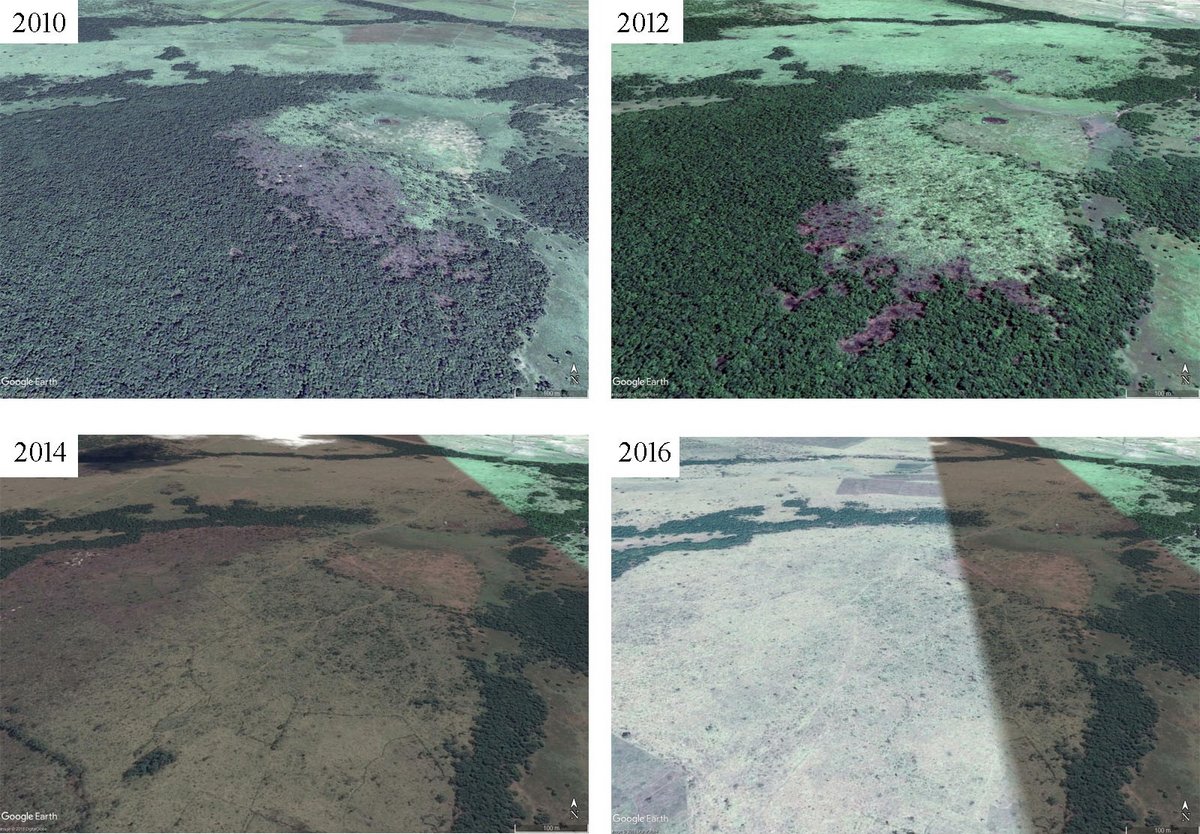
Over the past decades, changes in land tenure, livestock overgrazing, poaching, and fencing have caused severe challenges for wildlife populations in Greater Mara. Effective landscape planning and conservation efforts require a large-scale overview of land surface patterns and ecosystem dynamics, e.g. when migration routes are blocked by incompatible land uses. However, such information is currently lacking. In this study, we exploit long-term satellite records to quantify how different land-use and management types affect vegetation dynamics and land cover. We focus on contrasting unprotected land, community-based conservation with regulated livestock grazing, and fully protected land that excludes livestock.
Plan:
The project will be carried out from spring 2017 to spring 2018.
Partners:
Jens-Christian Svenning - Aarhus University, Denmark
Wang Li - Aarhus University, Denmark
Robert Buitenwerf - Aarhus University, Denmark
Michael Munk - Aarhus University, Denmark
Irene Amoke - Kenya Wildlife Trust, Kenya
Peder Klith Bøcher - Aarhus University, Denmark