PhD project on Managing East African Savannas with Remote Sensing
Past, Present and Future Dynamics of Vegetation under Anthropogenic Pressure
PhD student Michael Munk
Supervisor: Professor Jens-Christian Svenning
Decision makers, in the Mara-Serengeti Ecosystem, are faced with challenges like increasing human population, and abrupt changes from the pastoralist lifestyles to agricultural practices. This transition calls for new approaches to monitor and facilitate coexistence.
The main aims of this PhD project are to: 1) provide and develop cutting-edge remote sensing research on savannah ecosystem dynamics, 2) support local decision makers, 3) improve landscape management in future human-wildlife coexistence areas and 4) assess the scope for ecological and societal developments in the Anthropocene to preserve and restore megafauna populations in the future – with focus on the Maasai Mara and Serengeti ecosystems.
A couple of examples from current and ongoing projects are listed below.
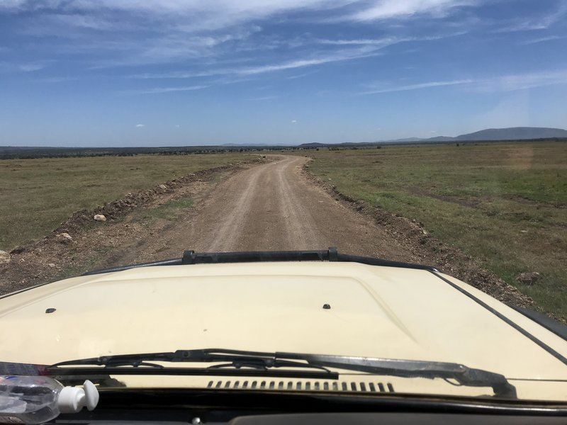
Scarring landscapes – using high resolution satellites (ESA Sentinels and DigitalGlobe WorldView3) to monitor 4 years of road development, edge effects and desertification of Maasai Mara, Kenya
This project will quantify the extent of desertification around three landscape structures 1) roads and tracks, 2) human settlements including shopping centers and 3) administrative borders using remote sensing techniques including very-high resolution WorldView3 satellite imagery

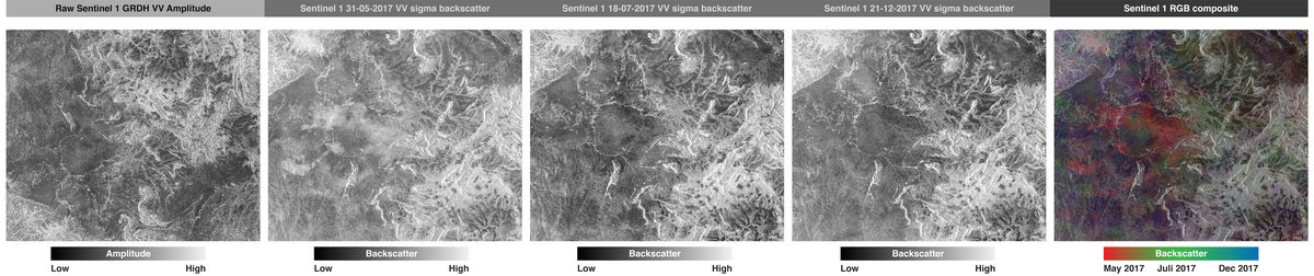
Tracking the Great Migration from Space – grassland dynamics of the Maasai Mara-Serengeti ecosystem
This project will investigate the possibility to detect the timing of the great migration (e.g. wildebeest and zebras) in their entire annual circle around the Mara-Serengeti ecosystem using new remote sensing methods - combining optical and radar satellite-based sensors from European Space Agency (ESA).
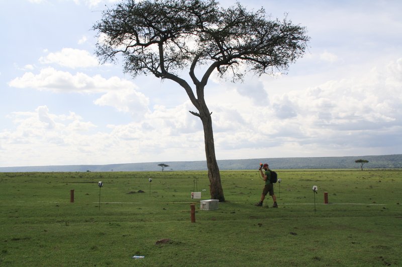
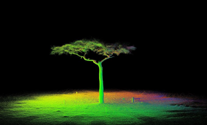
Are the Spotted Land Losing its Spots – 3D Laser Scanning, High Resolution Satellite and Historical Aerial Imagery of Free-Standing Trees in the Maasai Mara Ecosystem
This project will assess number and distribution of free-standing trees in the Greater Maasai Mara Ecosystem. Also, linking species specific structural properties derived from LiDAR to spectral properties of very high-resolution imagery from WorldView3.
Domestic Dogs Dominating Maasai Mara – Using Satellite Imagery, GPS Collars and Questionnaires to Estimate Biomass of Domestic Dogs (Canis familiaris) and their Potential Roaming Extent in Maasai Mara
This project will estimate the potential population size, biomass and roaming extent of domestic dogs (Canis familiaris) in the Maasai Mara ecosystem using high-resolution satellite imagery, data from GPS-collared dogs and questionnaires in the local community.
